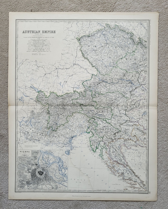
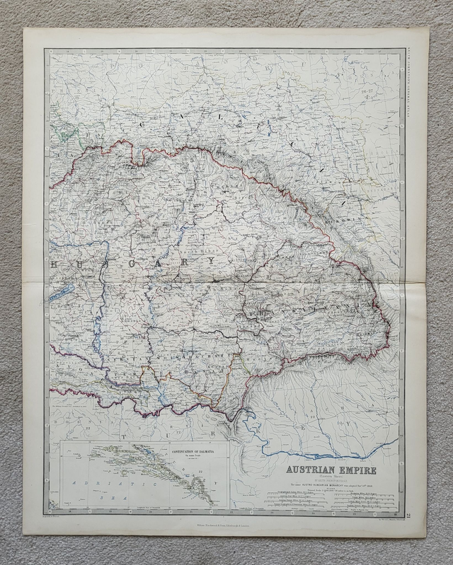
Austrian Empire (East and West)
£78.00
REF = 16874
Austrian Empire (East and West)
This pair of authentic antique maps were published in 1861 by Blackwood/Johnston. They are hand-coloured and each one measures 62.0 x 49.5 cm.
Together, they cover the territory from Transylvania in the east to Tyrol in the west. And from Bohemia in the north to Dalmatia in the south.
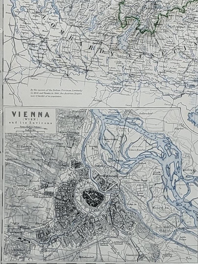
The western map includes a snapshot of Vienna in the bottom left corner.
Before mailing, these maps will be folded along their natural folds, and dispatched in a cardboard-backed envelope.
Price = £78
Includes FREE DELIVERY to UK addresses (Royal Mail Tracked 24)
+++
Please note: authentic antique and vintage maps sometimes have minor blemishes such as: foxing; folds; creases; and stains. Please check the photographs carefully before ordering.
Austrian Empire (East and West)
This pair of authentic antique maps were published in 1861 by Blackwood/Johnston. They are hand-coloured and each one measures 62.0 x 49.5 cm.
Together, they cover the territory from Transylvania in the east to Tyrol in the west. And from Bohemia in the north to Dalmatia in the south.
The western map includes a snapshot of Vienna in the bottom left corner.
Before mailing, these maps will be folded along their natural folds, and dispatched in a cardboard-backed envelope.
Price = £78
Includes FREE DELIVERY to UK addresses (Royal Mail Tracked 24)
+++
Please note: authentic antique and vintage maps sometimes have minor blemishes such as: foxing; folds; creases; and stains. Please check the photographs carefully before ordering.
Share