Cirencester and Cotswolds
£32.00
REF = 15318
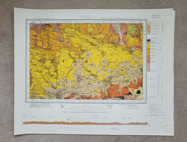
This geological map covers the area to the north and the northeast of Cirencester, including a large piece of the Cotswolds.
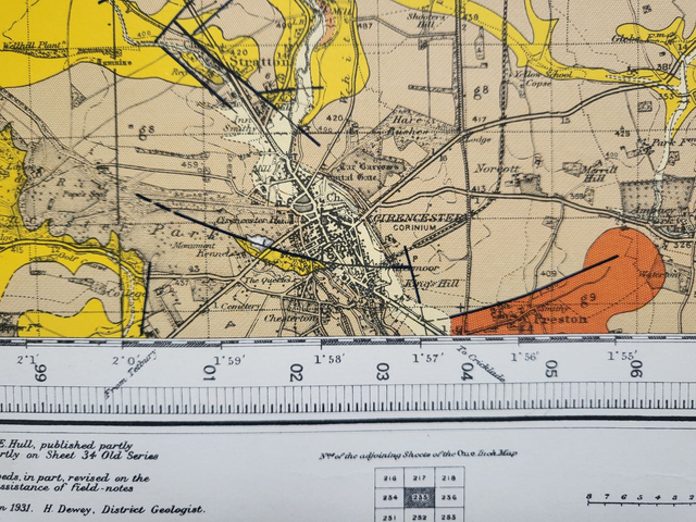
Cirencester is located in the bottom left of the map (see Photo 2.)
It was published in 1962 by the Ordnance Survey and measures approximately 63 x 50 cm.
Geological maps are both beautiful and fascinating. They look great when framed and make striking additions to the walls of homes, pubs, offices and restaurants.
Prior to delivery, this map will be rolled and then mailed in a cardboard tube.
Price = £32
Includes FREE DELIVERY to UK addresses (Royal Mail Tracked 24)
+++
Please note: authentic antique and vintage maps sometimes have minor blemishes such as: foxing; folds; creases; and stains. Please check the photographs carefully before ordering.
This geological map covers the area to the north and the northeast of Cirencester, including a large piece of the Cotswolds.
Cirencester is located in the bottom left of the map (see Photo 2.)
It was published in 1962 by the Ordnance Survey and measures approximately 63 x 50 cm.
Geological maps are both beautiful and fascinating. They look great when framed and make striking additions to the walls of homes, pubs, offices and restaurants.
Prior to delivery, this map will be rolled and then mailed in a cardboard tube.
Price = £32
Includes FREE DELIVERY to UK addresses (Royal Mail Tracked 24)
+++
Please note: authentic antique and vintage maps sometimes have minor blemishes such as: foxing; folds; creases; and stains. Please check the photographs carefully before ordering.
Share