Leicestershire
£38.00
REF = 13982
'Leicestershire'
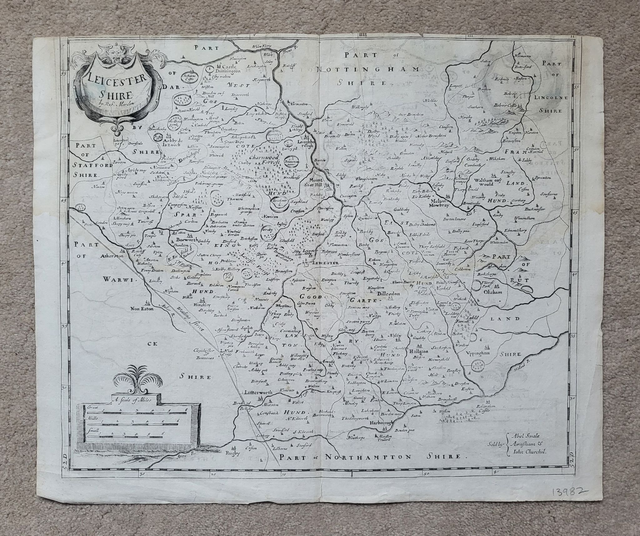
This authentic, un-coloured, antique map of Leicestershire by Robert Morden was published in circa. 1720. It is unmounted and measures approximately 45 x 38 cm.
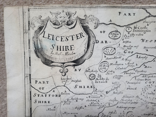
The map area is generally good, but please be aware that there is no top margin. There are also some ink imprints - where the map has been folded over - particularly in the top right corner.
Prior to shipping, the map will be folded along the original centre fold and mailed in a cardboard -backed envelope.
Price = £38
Includes FREE DELIVERY to UK addresses (Royal Mail Tracked 24)
+++
Please note: authentic antique and vintage maps sometimes have minor blemishes such as: foxing; folds; creases; and stains. Please check the photographs carefully before ordering.
'Leicestershire'
This authentic, un-coloured, antique map of Leicestershire by Robert Morden was published in circa. 1720. It is unmounted and measures approximately 45 x 38 cm.
The map area is generally good, but please be aware that there is no top margin. There are also some ink imprints - where the map has been folded over - particularly in the top right corner.
Prior to shipping, the map will be folded along the original centre fold and mailed in a cardboard -backed envelope.
Price = £38
Includes FREE DELIVERY to UK addresses (Royal Mail Tracked 24)
+++
Please note: authentic antique and vintage maps sometimes have minor blemishes such as: foxing; folds; creases; and stains. Please check the photographs carefully before ordering.
Share