Italy in the Time of Napoleon I (in Dutch)
£42.00
REF = 17227
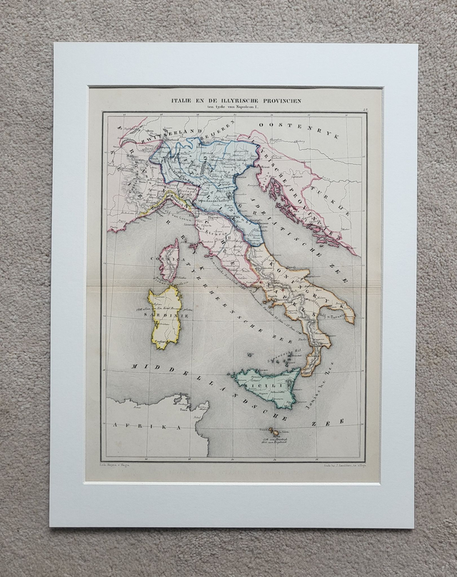
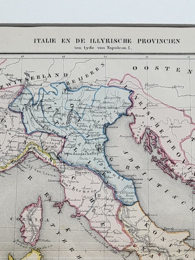
'Italie En De Illyrische Provincien'
This authentic, hand-coloured antique map was published in The Hague by J. Smulders. It shows Italy and the Illyrian Provinces (in the NW Balkans) in the time of Napoleon Bonaparte. Printed in 1858, it is credited to De Erven Thierry en Mensing.
It is presented in a 16 x 12-inch mount which will fit neatly into a standard-sized frame.
Price = £42
Includes FREE DELIVERY to UK addresses (Royal Mail Tracked 24)
+++
Please note: authentic antique and vintage maps sometimes have minor blemishes such as: foxing, folds, creases, and stains. Please check the photographs carefully before ordering.
Share