Europe - Around the Year 1810 (in Dutch)
£42.00
REF = 17229
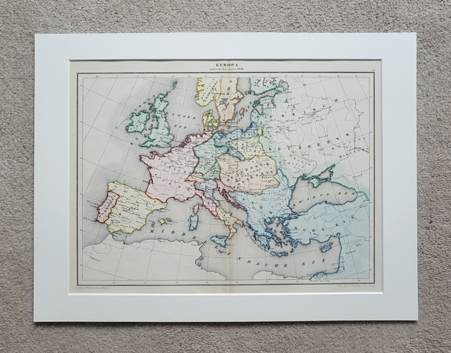
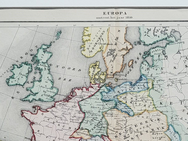
'Europa Omtrent Het Jaar 1810'
This authentic, hand-coloured antique map was published in The Hague by J. Smulders. It shows the national borders of Europe around 1810. Printed in 1858, it is credited to De Erven Thierry en Mensing.
It is presented in a 16 x 12-inch mount which will fit neatly into a standard-sized frame.
Price = £42
Includes FREE DELIVERY to UK addresses (Royal Mail Tracked 24)
+++
Please note: authentic antique and vintage maps sometimes have minor blemishes such as: foxing, folds, creases, and stains. Please check the photographs carefully before ordering.
Share