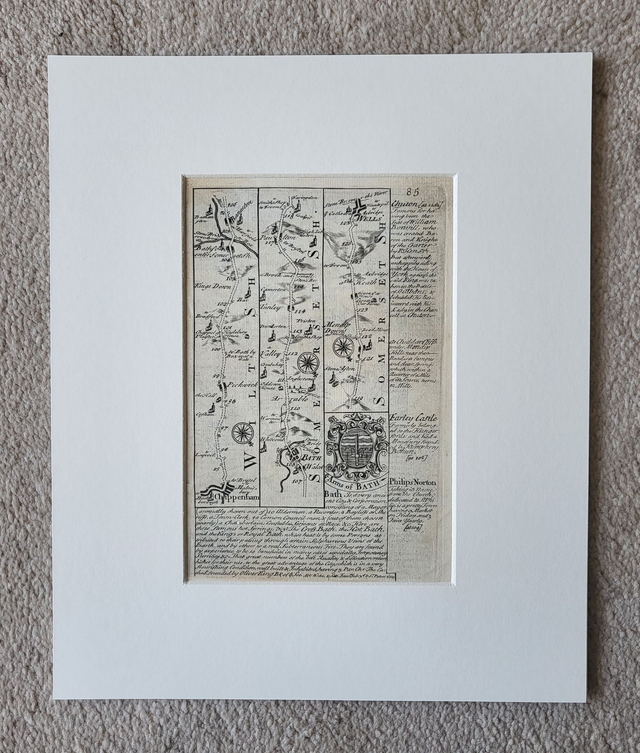
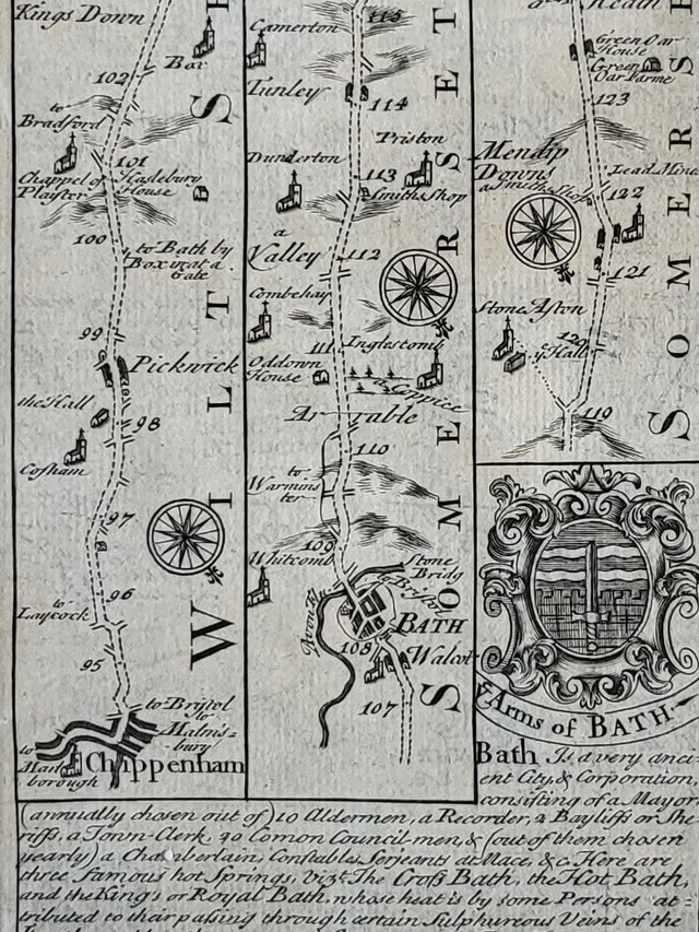
Chippenham, Bath, Wells (strip map)
£24.00
REF = 17173
The Road from Chippenham to Wells (via Bath)
This authentic antique map was published in circa. 1750 by John Owen and Emmanuel Bowen.
Originally published in 'Britannia Depicta', strip maps were used to navigate the roads of Britain in the 18th century. The traveller starts at the bottom of the left-hand column and traces his/her journey upwards. Then he/she moves to the bottom of the second column, and so on. In the absence of road numbers, the traveller is guided by the landmarks along the way. Hence, the map maker includes hills, road junctions, rivers and other notable features.
This map is presented in a 12x10 inch mount which will fit neatly into a standard-sized frame.
Price = £24
Includes FREE DELIVERY to UK addresses (Royal Mail Tracked 24)
+++
Please note: authentic antique and vintage maps sometimes have minor blemishes such as: foxing; folds; creases; and stains. Please check the photographs carefully before ordering.
Share