Burry Inlet and Tenby (South Wales)
£32.00
REF = 10954
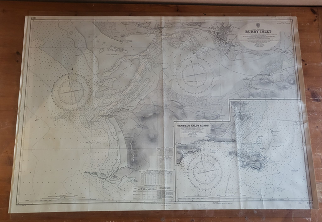
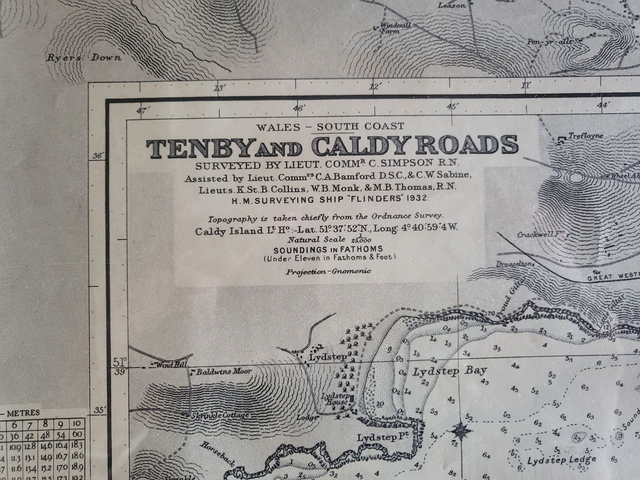
'Burry Inlet and Tenby'
This authentic, vintage nautical map covers the South Wales coast from Llanelly in the north to Worm's Head (Gower) in the south, with an additional map in the corner of Tenby.
It is 102 x 69 cm, and it was published in 1963 by the UK Admiralty.
The photos show the map laid out on a table with a piece of glass on top. This gives a good idea of what it would look like if it were framed behind glass.
Please note the fold down the middle of the map. Hence, if it was framed behind glass, the fold would still be apparent.
The map will be mailed in a cardboard tube.
Price = £32
Includes FREE DELIVERY to UK addresses (Royal Mail Tracked 24)
+++
Please note: authentic antique and vintage maps sometimes have minor blemishes such as: foxing; folds; creases; and stains. Please check the photographs carefully before ordering.

Share